Are you curious about what the underwater acres of the Reserve look like?
ROV Kraken2
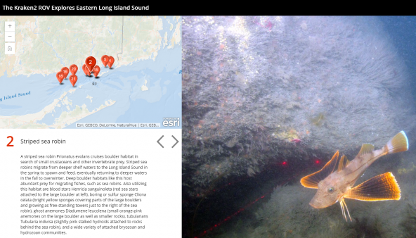
Jump “on board” The Kraken2, a remotely operated vehicle (ROV), to explore the underwater habitats of the Long Island Sound. Start your underwater tour. This research effort was part of a larger project to map the seafloor using various techniques. The information that scientists collect will identify areas that should be protected and areas that may be more suitable for the placement of energy and other infrastructure.
Underwater footage
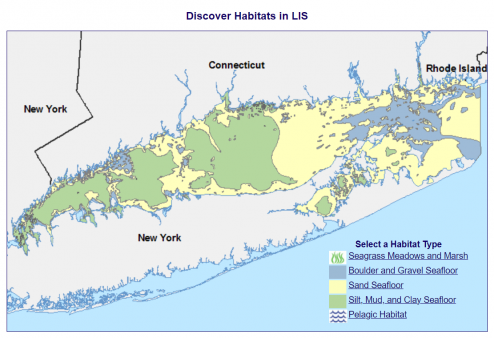
Explore imagery from 370 research dives in Long Island Sound using underwater technologies like SCUBA, remotely operated vehicles (ROVs) and human-occupied submersibles. The Reserve’s seafloor is mostly boulder, gravel, and sand. Explore boulder and gravel seafloor imagesand sand seafloor images.
Check out the view from the CT Reserve headquarters using the camera above our office!

Bird’s eye view
The UConn Avery Point campus overlooks eastern Long Island Sound. Straight ahead, you’ll see the Avery Point Lighthouse. Built in 1944, this 41-foot tall lighthouse is solar powered and sends off a green flash every 4 seconds. If you pan to the left (east), you’ll see Pine Island, a State Archaeological Preserve with rich history. Beyond Pine Island is Bluff Point State Park, another Reserve site. If you pan to the right (west), you’ll see the New London coastline.